Alfred advances – brace for impact
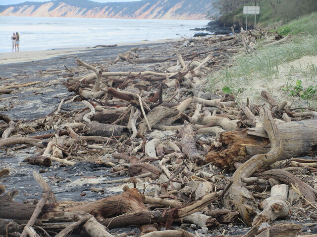
Cyclone debris - tonnes of driftwood, including whole trees, washed up on Rainbow Beach after beinggcouged out of the ground, possibly at Bribie Island. (464256_01)

Tropical Cyclone Alfred’s much anticipated landfall is now forecast for tomorrow.

“Alfred is most likely to cross over the Moreton Bay Islands Saturday morning before crossing to the mainland coast,” according to latest advice from the Bureau of Meteorology.

Unusually large surf has dumped many tonnes of driftwood on the beach, including some whole trees, possibly including some gouged out of Bribie Island’s nokrthern end, exposing calm water areas at Caloundra to the open ocean.

Heavy rainfalll is continuing to develop, with heavy and locally intense rainfall potentially creating the danger of flash flooding, possibly life threatening.

Rain is likely to set in tonight in many areas and increase into Saturday.

“Once Alfred crosses the coast, it is likely to weaken below tropical cyclone strength later on Saturday.

Abnormally high tides are likely to continue causing minor flooding in some coastal low lying areas.

Damaging surf is also predicted to recur.

Gales with damaging wind gusts to 120km/h are right now occurring near the coast between Cape Moreton and Yamba.

They are also expected to bring damaging gusts, including to Double Island Point tonight or during Saturday morning as Alfred approaches the coast.

Although Alfred is expected to weaken and move inland during Saturday, damaging gusts may continue, particularly over elevated terrain, during Saturday.

The cyclone is still at Category 2 intensity, with sustained winds near the centre of 95km/h and gusts to 140km/h.

It is moving at a torturous 7km/h.

A map showing the track of the cyclone is available at: www.bom.gov.au/cyclone