10.15 UPDATE: Road closures and floods
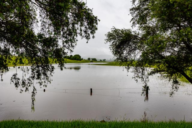
Major flooding is occurring at Miva and Tiaro, with less severe flooding at Dagun Pocket and Gympie this morning.
The Cooloola Coast has lost its main trade and visitor link, with flooding near Goomboorian.
Flash flooding was also reported for the Six Mile Creek and Cooroora Creek Bridges near Pomona.
Power outages blamed on damage needing emergency repairs were also reported to the north and west, at Gunalda, Miva, Sexton, Theebine, Goomeri, Boonara and Booubyjan.
Heavy rain over the Mary River catchment has included falls of more than 300mm, with localised heavy falls in excess of 500mm to 600mm, especially in central areas of the catchment.
Those are figures to 9am, coming on top of heavy rainfall on Thursday evening and overnight, with further heavy rain either falling or on the way.
This rainfall has led to rapid river level rises across parts of the Mary River catchment. Further heavy rainfall is likely to lead to further river level rises.
This is the latest BoM advice:
Mary River to Gympie:
Moderate flooding may occur along the Mary River to Gympie.
The Mary River at Dagun Pocket is currently at 10.8m and steady, with minor flooding. The river level may reach the moderate flood level (13m) overnight Saturday into Sunday, with forecast rainfall.
The Mary River at Gympie is currently at 10.01m and rising, with minor flooding. The Mary River at Gympie may reach the moderate flood level (12 m) this afternoon.
Six Mile Creek:
Strong creek level rises have been observed in upper parts of the Six Mile Creek with minor flooding at Cooran and Lake MacDonald Drive.
Mary River downstream of Gympie:
Major flooding is expected along the Mary River downstream of Gympie.
The Mary River at Miva is currently at 18.43m and rising, with major flooding. The Mary River at Miva is expected to remain above the major flood level (15.5m) all day today, with further rises possible.
The Mary River at Tiaro is currently at 13.5m and rising, with major flooding. The Mary River at Tiaro is expected to remain above the major flood level (12.00 m) during Saturday. Further river level rises are possible with forecast rainfall.
Tinana Creek:
Strong creek level rises are being observed in upper parts of the Tinana Creek catchment, with Tagigan Rd above the major flood level and rising.
Next Issue:
The next warning will be issued by 02:00 pm EST on Saturday 08 January 2022.
Latest River Heights:
Location Height of River (m) Tendency Date/Time of Observation
Obi Obi Ck at Baroon Pocket Dam Alert -0.24 Rising 09:00 AM SAT 08/01/22
Mary R at Conondale Alert 2.30 Falling 09:10 AM SAT 08/01/22
Mary R at Bellbird Creek TM 4.03 Falling 09:20 AM SAT 08/01/22
Mary R at Kenilworth H/S Alert 5.35 Rising 09:38 AM SAT 08/01/22
Mary R at Moy Pocket TM 10.19 Steady 09:17 AM SAT 08/01/22
Yabba Ck at Borumba Dam HW Alert 1.69 Falling 08:46 AM SAT 08/01/22
Yabba Ck at Imbil Alert 5.49 Rising 09:28 AM SAT 08/01/22
Kandanga Ck at Hygait TM 5.71 Steady 09:20 AM SAT 08/01/22
Mary R at Dagun Pocket Alert 10.80 Falling 09:51 AM SAT 08/01/22
Six Mile Ck at Lake MacDonald Dam Alert 95.92 Steady 09:33 AM SAT 08/01/22
Six Mile Ck at Cooran TM 6.83 Rising 09:20 AM SAT 08/01/22
Deep Ck at Cedar Pocket Dam HW Alert 101.73 Falling 09:19 AM SAT 08/01/22
Mary R at Gympie Alert 10.01 Rising 09:49 AM SAT 08/01/22
Mary R at Fisherman’s Pocket TM 12.16 Rising 09:20 AM SAT 08/01/22
Wide Bay Ck at Brooyar TM 10.94 Falling 09:10 AM SAT 08/01/22
Mary R at Miva TM 18.43 Steady 09:00 AM SAT 08/01/22
Munna Ck at Marodian TM 16.31 Falling 09:15 AM SAT 08/01/22
Mary R at Home Park 18.44 Rising 09:20 AM SAT 08/01/22
Mary R at Tiaro Alert 13.50 Rising 09:51 AM SAT 08/01/22
Mary River at Owanyilla Alert 8.80 Falling 09:51 AM SAT 08/01/22
Mary R at The Barrage TM 7.89 Rising 09:05 AM SAT 08/01/22
Tinana Ck at Tagigan Rd 5.74 Steady 09:15 AM SAT 08/01/22
Tinana Ck at Bauple East TM 10.52 Rising 09:20 AM SAT 08/01/22
Tinana Ck at Teddington Weir TM 10.70 Rising 09:37 AM SAT 08/01/22
Tinana Ck at Tinana Barrage TM 4.33 Rising 09:00 AM SAT 08/01/22
Mary R at Portside Alert 2.66 Rising 09:48 AM SAT 08/01/22
Roads close as floods isolate Gympie
Major road links are cut between Gympie and many of its near-neighboring townships as floodwaters rise.
High river and local water levels threatened to isolate many residents, including the Cooloola Coast and parts of the Mary Valley.
Major flooding has cut the Bruce Highway north of Curra and now threatens Tiaro.
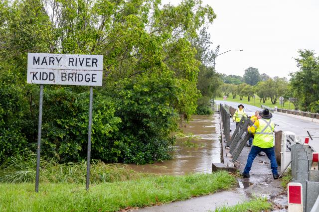
Floods have closed Traveston Crossing Rd at Amamoor, Tin Can Bay Rd at Goomboorian, Randwick Re at East Deep Creek, Yabba Creek Rd, Imbil, Lower Wonga State Route 49 at Lower Wonga, East Deep Creek Rd at Monkland, Noosa Rd at Mothar Mountain, Exhibition Rd at Southside at Kidd Bridge, Kenilworth Skyring Creek Rd at Tuchekoi, while traffic is disrupted on David Drive Curra.
Flooding has also closed the Burnett Highway at Goomeri, Woolooga Rd at Widgee, Kilkivan Tansey Rd,
the Wide Bay Highway at Lower Wonga and Glastonbury Road near Southside.
The Mary River is in flood to Gympie’s north and moderate flooding is headed Gympie’s way in coming hours.


